|
Erie Lackawanna - Huntington County, Indiana |
|||||||||||||||
|
|||||||||||||||
|
Erie Lackawanna - Huntington County, Indiana |
|||||||||||||||
|
|||||||||||||||
 |
 |
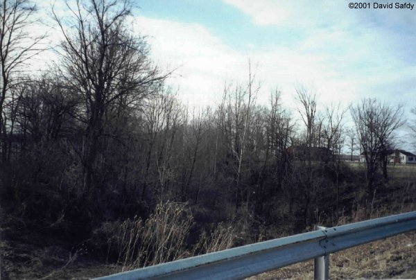
 At Simpson,
Indiana the tracks ran right next to this co-op elevator. The only
evidence of the EL here is the remaining telegraph pole to the left which
still has wires hanging from it. There once was a radio base station
in this area, but nothing remains of it. At Simpson,
Indiana the tracks ran right next to this co-op elevator. The only
evidence of the EL here is the remaining telegraph pole to the left which
still has wires hanging from it. There once was a radio base station
in this area, but nothing remains of it. |
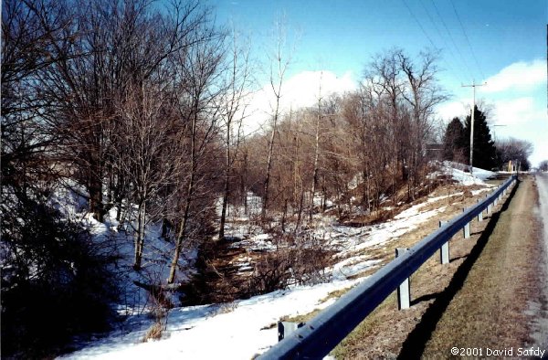
 At Market
St. in Huntington this track is the sole survivor of the EL. It is
the leftover interchange track with the N&W (later NS) who used it
in the post-EL era to access a few businesses in the area. The passenger
station was to the right of this track on the opposite side of Market St. At Market
St. in Huntington this track is the sole survivor of the EL. It is
the leftover interchange track with the N&W (later NS) who used it
in the post-EL era to access a few businesses in the area. The passenger
station was to the right of this track on the opposite side of Market St. |
Market Street Comparisons: 1965 vs. 1999

Side by side comparisons taken at Market St. in Huntington. The capture on the left was taken from the Revelation Video "EL Legacy" and is around 1965 in Huntington (photographer is in the video's credits). The picture on the right was taken in 1999 and we are facing eastward on the EL in both photos looking at Market St. The Alco PA's are to the right of the where the truck trailers are on the left in the 1999 view. The remaining rail is the one to the left of the Alco PAs. The large fuel tank is now a memory. It's pretty incredible how things can change in 30 years. |
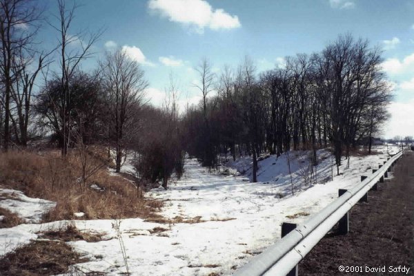
 Looking
northwest down the EL right-of-way in Huntington from the ex-N&W diamond.
The mains ran to the right of the tractor trailers which are parked on
the left in this photo and the street in the foreground never crossed the
EL - it was lengthened after the tracks were pulled up. Looking
northwest down the EL right-of-way in Huntington from the ex-N&W diamond.
The mains ran to the right of the tractor trailers which are parked on
the left in this photo and the street in the foreground never crossed the
EL - it was lengthened after the tracks were pulled up. |
|
|
 |
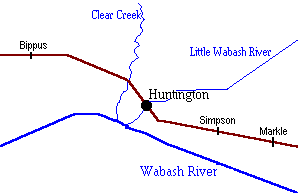
| Huntington, Indiana Rail Map
This map/diagram I created to show a bit more detail of how the Erie
Lackawanna passed through Huntington.
|
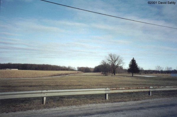
The Erie Lackawanna mainline crossed Business US 24 on a bridge before it ran northwest towards Huntington College. In this location today there is just a slight trace of the railroad. A view looking eastbound across US 24. Below on the right there is a concrete telephone shanty. I have seen pictures of this up on top of the right of way. In the distance is the north end of Yeoman Park and you can see its brick sign in the grass. There is noticable trace of the grade in the distance. Taken 2/18/01. (49K photo) |
Northwest of Huntington, both Huntington County Road 300W and Clear Creek Road crossed the Erie Lackawanna mainline on similar looking bridges which went up and over the double track line. The tracks in this area ran through a cut and a train passing through here would be lower than the ground, but the top 1/2 or so of the train would still stick up above the ground. Both bridges have been long removed today, but evidence of the railroad is still present at both locations. County Road 300W
Clear Creek Rd.
|
 Just
east of SR 5, this is the steel bridge over County Road 700N about 3 miles
northwest of Huntington. On the south side of this bridge is the
skeleton of a semaphore. Just 100' or so to the south is the Clear
Creek bridge which still stands. Just
east of SR 5, this is the steel bridge over County Road 700N about 3 miles
northwest of Huntington. On the south side of this bridge is the
skeleton of a semaphore. Just 100' or so to the south is the Clear
Creek bridge which still stands. |
|
|
|
|
The bridge still stands over Clear Creak, for now.
|
|
|
|
|
At County Road 700N the bridge still stands. By the thickness of the trees and brush in this area, you would think this line was abandoned for a century or more. Looking west across the CR 700N bridge. Taken 1/1/06. (79K photo) |
 East
of Bippus, Indiana are the remnants of WO interlocking. To the right
is the signal mast which contains no lenses and the relay shed is on the
left buried in the weeds. This was the western end of the double
track from Marion, Ohio. East
of Bippus, Indiana are the remnants of WO interlocking. To the right
is the signal mast which contains no lenses and the relay shed is on the
left buried in the weeds. This was the western end of the double
track from Marion, Ohio. |
 The
WO signal mast looms high above. The
WO signal mast looms high above. |
 An encouraging message
inside the relay shed at WO, just a little too late. An encouraging message
inside the relay shed at WO, just a little too late. |
![]()
© Original Content Copyright 1999-2007
David Safdy
© Design and Updates Copyright 2005-2007
Greg Lavoie
Contacts
Disclaimer


 This
is the bridge over the Little Wabash River just southeast of E. State St. in
Huntington. This is looking westward (compass direction is north).
This
is the bridge over the Little Wabash River just southeast of E. State St. in
Huntington. This is looking westward (compass direction is north).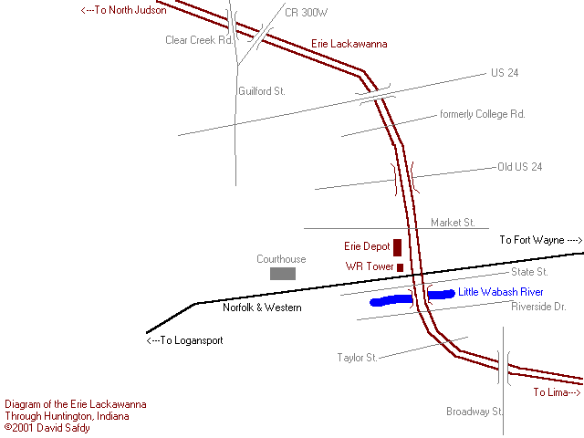