|
Erie Lackawanna - Wells County, Indiana |
|||||||||||||||
|
|||||||||||||||
|
Erie Lackawanna - Wells County, Indiana |
|||||||||||||||
|
|||||||||||||||
 |
 |

 Here we
are looking east down the Erie Lackawanna right-of-way at the Main St.
crossing in Tocsin, Indiana. On the north side of the grade is one
of the Erie trademark concrete telephone shanties still standing.
The roadbed bevel just east of this location is still very distinguished
from the surrounding area. Here we
are looking east down the Erie Lackawanna right-of-way at the Main St.
crossing in Tocsin, Indiana. On the north side of the grade is one
of the Erie trademark concrete telephone shanties still standing.
The roadbed bevel just east of this location is still very distinguished
from the surrounding area. |
|
|
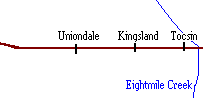
 This
is an aerial view of Kingsland, Indiana looking southeast. The yellow
line indicates the Erie Lackawanna right-of-way. The parallel road
above the line is U.S. 224 and the perpendicular railroad track is Norfolk
Southern's New Castle District. August 4, 2000. This
is an aerial view of Kingsland, Indiana looking southeast. The yellow
line indicates the Erie Lackawanna right-of-way. The parallel road
above the line is U.S. 224 and the perpendicular railroad track is Norfolk
Southern's New Castle District. August 4, 2000. |
 This was
the bridge over N. Meridian Rd, one mile east east of Uniondale right alongside
US 224. It was taken down sometime in late 1999/early 2000.
This was the last surviving EL road bridge in Indiana east of Huntington. This was
the bridge over N. Meridian Rd, one mile east east of Uniondale right alongside
US 224. It was taken down sometime in late 1999/early 2000.
This was the last surviving EL road bridge in Indiana east of Huntington. |
 
 Watch
out for poison ivy up here! It is hard to imagine that just 25 years
ago this was once a mainline railroad with 6-axle SD45's running hotshot
trailer trains across this bridge. Watch
out for poison ivy up here! It is hard to imagine that just 25 years
ago this was once a mainline railroad with 6-axle SD45's running hotshot
trailer trains across this bridge. |
 
This is what the same area looks like now. All of the concrete has been removed along with the steel bridge that once crossed Meridian Rd. This is looking west from atop the right of way. |
 This
is looking east from the former EL bridge over Meridian Rd. US 224
is just a 100 feet or so to the right down the hill. This
is looking east from the former EL bridge over Meridian Rd. US 224
is just a 100 feet or so to the right down the hill. |
 In
Uniondale, Indiana milepost M112 has been moved across the street as a
monument to the railroad that once passed through here. The EL mains
were to the right of the street. In
Uniondale, Indiana milepost M112 has been moved across the street as a
monument to the railroad that once passed through here. The EL mains
were to the right of the street. |
 Looking
east down the EL right-of-way at Uniondale. To the right is US 224
and the telephone poles on the right are not associated with the railroad. Looking
east down the EL right-of-way at Uniondale. To the right is US 224
and the telephone poles on the right are not associated with the railroad. |
Milepost M115 resides between Markle and Uniondale, just west of County Road 300W. To the right side of this milepost is County Road 600N, which paralleled the north side of the EL between Uniondale and Markle. When the trees have leaves on them it is nearly impossible to find this milepost. Photo taken 3/11/01. (94KB) |
![]()
© Original Content Copyright 1999-2007
David Safdy
© Design and Updates Copyright 2005-2007
Greg Lavoie
Contacts
Disclaimer